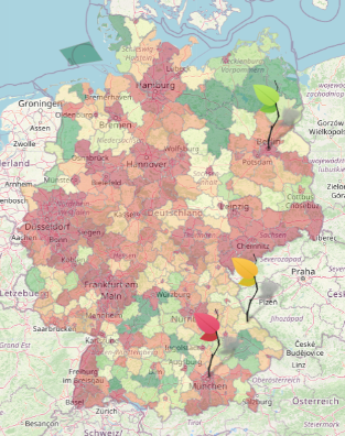
Sustainability Mirror for Germany
Environmental pollution is increasingly becoming a critical issue in the global community. Much of this pollution comes from human production and consumption of electricity. The main aim of this project, in cooperation with a large national energy provider, is therefore to try to raise awareness of these matters among the people. In this case the focus is purely set on Germany. The result displays a live map of Germany that shows the actual amount of CO2 emissions derived from the consumption and the production of energy on a county level. Moreover, this sustainability mirror shows details about the different sources of electricity.
Machine learning for earth observation gap filling, and gap filling validation
Clouds are a major and well-known issue when working with earth observation (EO) data. Dense clouds obstruct the earth surface and thus generate gaps in the data. This project revolved around the filling of those gaps. Specifically, the project consisted of two parts: First, machine learning (ML) possibilities for the purpose of gap filling were investigated and a recently proposed ML approach was applied to the problem and evaluated. The second part of the project was the development of a Python package to facilitate the validation of gap filling methods.
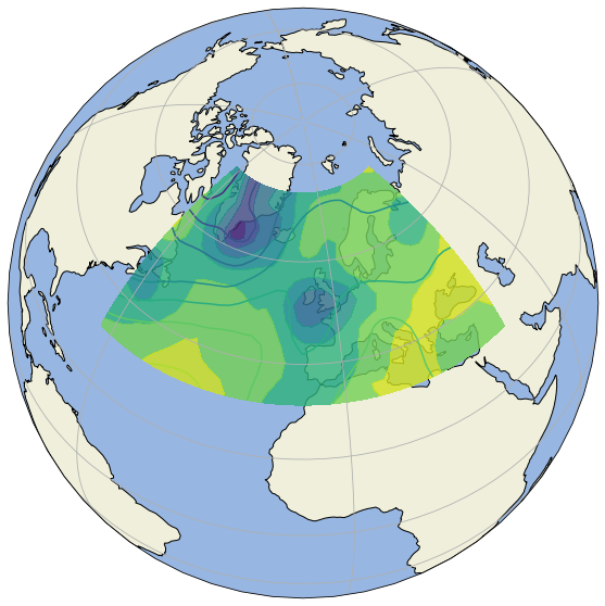
Climex - Predicting and Classifying European Weather Phenomena
The weather in Europe is mainly driven by high and low pressure systems and their constellations to each other. Typical constellations of high and low pressure systems are classified as atmospheric circulation patterns. The class “Tief Mitteleuropa” is known to occur rarely (~ 10 days/year), but when it does it often triggers extreme rainfall and floods in Central Europe. The more frequent class “Trog Mitteleuropa” with about 20 days/year is also related to heavy rainfall (Ustrnul & Danuta, 2001).
Investigating Satellite Imagery for Journalism
Together with a big media outlet, a team of students worked on using data obtainable from sattellite imagery for a journalistic project. The Goal of this Project was to create a tool that allows journalists to investigate several climate phenomena in a given area along with an analysis of their development over time. In the future, you might hear about the findings in the news!